Mineral Exploration Data Visualized
Black Mountain Mapping provides GIS and mapping support to mineral exploration clients. Assembling, displaying and presenting mineral exploration results for technical, corporate and investor relation audiences.
Presenting Mineral Exploration Data
Since 2003, Black Mountain Mapping was the pathway which allowed Dennis Doulos to provide independent mapping support to mineral exploration clientele. With over 30 years of experience, a variety of visual techniques have been applied to display complex 3D geological concepts on a 2D screen. Map images that can be focused for technical, corporate or investor presentations on projects ranging from grass root to resource level projects around the globe.
Visualize Geological Data with Advanced Mapping Solutions
Explore Black Mountain Mapping’s comprehensive GIS and mapping services, ensuring clarity and timely results.
Technical Applications
Supporting geology teams with data management, hardcopy and digital maps for planning, execution and follow up field programs.
Corporate Compliance
Provide business solutions through mapping and spatial data management to administrative teams for regulatory and auditing compliance, First Nations correspondence, land tenure, permitting, and assessment reports.
Investor Relations
Tailored map imagery to effectively communicate exploration results and future plans for shareholder conferences, news releases or websites.
Custom GIS Mapping for Mineral Explorers
Highlighting significant project results, show casing potential, and planning follow up programs.
Data Integration
Combine variety of exploration datasets and file formats into a common platform for clarity and analysis.
GIS Mapping & Data Organization
Organize and maintain spatial dataset packages to visualize and evaluate project data and highlights quickly and effectively. Facilitate technical team activities, data rooms, and 3rd party evaluations.
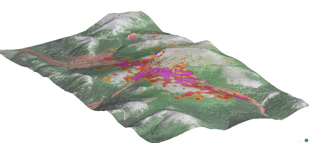
3D Modelling
Assemble complex 3D geological environments and prepare clear, impactful visuals for investors.
Customized Maps
Presenting a variety of datasets to support planning and exploration with clear concise imagery depicting results.
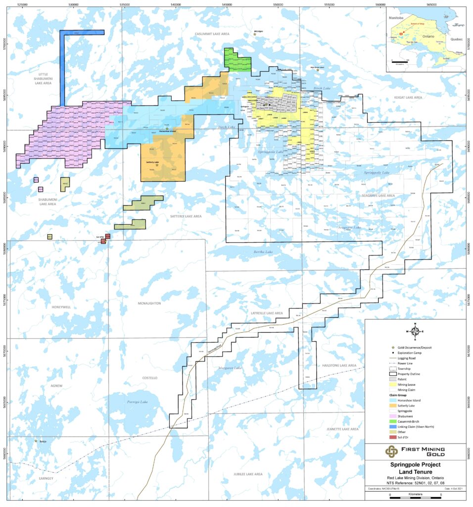
Mining Claim Activity Reports – CANADA
Mining claim activity reports summarize and display mining claims acquired in previous 30 days for each Canadian Province / Territory
Downloadable PDF summary reports available at the beginning of each month.
Visualizing Mineral Exploration Success, One Map at a Time
Explore key insights and communicate potential to investors, track milestones and drive measurable outcomes.
Technical Maps
News Release Support
Project Location Imagery
Investor Conference Posters

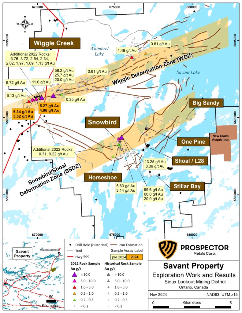
Geological Modelling
Geological Illustrations

Special Projects
+30 Years
Mineral Exploration Experience
+ 5,000 Maps
Delivered
+ 100 Clients
Supported
Custom GIS Insights for Mineral Exploration
Discover how our mapping solutions can enhance your exploration results—reach out today to learn more or schedule a consultation.
Expert GIS Solutions Tailored for Mineral Discovery
Reach out for effective mapping support.